During our trip to Bolivia, we truly enjoyed visiting Incan ruins such as Incallajta and Tiwanaku. We learn so much about the ancient civilizations of Rome and Egypt, but very little is taught in schools about the Inca and the empire that they created in South America. Its size and political systems rivaled any other empire of the early 16th century. While we were in the ruins of Incallajta, we walked the same paths that the guards walked around the ancient city as they protected it from rival tribes that lived in the forests. Since there were no other tourists at the site and it was just us and our guide walking the trails, it was especially awe-inspiring. We climbed to about 11,000 feet (about 3,350 meters) where we had a spectacular view of the entire complex. Join us on the trails of the ancient Inca and walk with us as we traverse the outer wall of the ancient city of Incallajta.
Walking an Incan TrailLooking Down on the RuinsWalking along the Ancient WallsAncient Trails Converted to RoadsThe Path of the Incan GuardsView from the Observatory
When traveling to someplace new, the first glimpse of that location is often out of the window of a plane. There is nothing like the excitement that you feel when you hear the plane going into the final approach of your destination. As the ground gets closer and the various sights come closer into view, it becomes a reality that you are about to see a new place that you haven’t visited before. Often the landscape looks the same as other places you may have gone to before, but there is always something different about this new city or country as it comes into view. For this week’s Cee’s Which Way Photo Challenge, we are sharing some photos from recent flights and our first views of cities.
Landing in Frankfurt, GermanyFlying over La Paz, BoliviaFlying over the Mountains of Northern ItalyGetting Ready to Land in Vienna, AustriaOur First Glimpse of GreeceFlying into Cochabamba, Bolivia
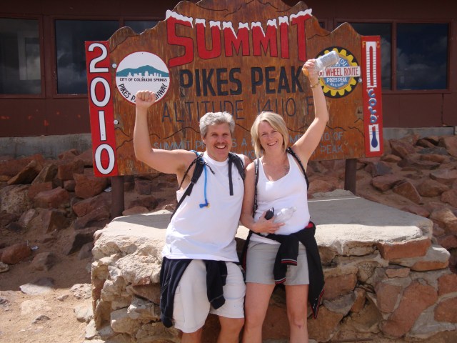
One of the most difficult hikes that we have ever done was our hike from the base of Pikes Peak to the summit. The entire hike is over twelve miles and has an elevation gain of over 7,000 feet (2,100 meters) to the peak, which is at 14,114 (4,301 meters). It certainly is not a hike for novices and was very much a challenge for us and we hike on a routine basis. Barr trail starts in the town of Manitou Springs and quickly ascends into the Pike National Forest. It was important to time when we did the hike because even in the middle of summer it can snow on the top of Pikes Peak, so we hiked in August on a day when we knew that the temperatures would be fine at the base as well as the summit.
Early in the HikeSign on Barr Trail, about 3 miles into the hikeView of Pikes Peak from Barr TrailLower Barr Trail
The hardest part of the trail was when we reached the tree line at 11,000 feet (3,350 meters) and the air thins out. The Summit House sits on top of Pikes Peak and is a restaurant and souvenir shop, which is visible from the base on a clear day. Once you reach the tree line, the point where the air is too thin for plants to grow, the Summit House seems like it should be close, but it is still a couple of hours away. The total hike took us about 8 hours, although we took our time and paced ourselves.
Steep Hike at PointsBarr Trail at Tree LineSo Close and Yet So FarView from Barr Trail, Garden of the Gods at the Base of the Mountain
For this week’s Cee’s Which Way Photo Challenge, we thought that we would share a few photos from that strenuous hike. As we prepare to return to South America and hike in the Andes Mountains, our minds have returned to this hike several times.
Sign for the SummitMiddle of the HikeStanding on Top of Pikes PeakWe Were Exhausted When We Reached the Summit