Gibraltar – A Foreign Outpost

When we were in southern Spain a few years ago, we visited Gibraltar, which is a British territory located on the most southern end of the Iberian peninsula.  Gibraltar is more of a sovereign city than a country, but despite its size, you still have to pass through customs and border patrol in order to enter and leave.  The Rock of Gibraltar is the most famous landmark of the region and is strategic due to its location on the entrance to the Mediterranean Sea from the Atlantic Ocean.  It is also the location of an important naval fortress that is built into the hills of the Rock of Gibraltar.  Gibraltar is distinctly British despite its location in southern Spain.  The pubs, the people, the atmosphere of the city almost all go out of their way to emphasize their allegiance to Britain and the United Kingdom.  It was very interesting to visit, but in many ways it was very odd, and to say that there is controversy over the ownership of Gibraltar would be an understatement.

View of Gibraltar
Barbary Macaque
Streets of Gibraltar
View of the Rock of Gibraltar Towering in the Distance

Before going, we talked to several people in Spain who had very strong opinions about this tiny country within a country.  First and foremost, the people of Spain believe that the land should be theirs and they believe that the citizens of Gibraltar are occupying foreign land.  In addition to that, the other thing that we were told was that there were huge problems with people going into Gibraltar and buying cigarettes and alcohol where it is cheaper and then selling it on the black market in other parts of Spain.  There are strict limits on how much alcohol and tobacco can be brought across the border, but due to the number of people crossing on a daily basis, obviously there is the opportunity for smuggling.  Regardless of the political friction, it was still an interesting place to visit.

Views from the Rock of Gibraltar
Rock of Gibraltar
One of the Fortresses
Sunset from the Top of the Rock of Gibraltar

Visiting the Rock of Gibraltar and walking the trails that led to the top was certainly the highlight of our visit there.  The views of the Strait of Gibraltar were certainly stunning and definitely worth the hard hike in the heat, even though we were there in November.  One of the more well-known, yet still interesting, things about the Rock of Gibraltar is the population of Barbary macaques that roam wild throughout the park area.  Although these monkeys are definitely cute, they are wild animals and have been known to attack people at times, but are more likely to steal anything held too loosely.  So, even though they make for great photo opportunities, don’t approach them and keep an eye on your possessions while you’re around them.

Moneys on the Trail
Another Barbary Monkey
Overlook at the Top
One of the Tunnels

Walking through the caves and tunnels that make up the fortifications was also quite fascinating.  There is also a cable car for those that don’t want to hike the steep trail to the top of the giant rock, but we would recommend only taking the cable car one direction and taking the time to either hike up or down since that is the only way to go into the fortifications that have been carved into the hillside.  The fortifications are no longer in use today and we couldn’t imagine how claustrophobic it must have been for the soldiers who manned the canons within the tunnels.  We definitely earned a pint by the time that we finished hiking around the Rock of Gibraltar.

Cavern in the Rock of Gibraltar
Another View of the Cavern
Walking the Tunnels
Cable Car

Despite the controversy that exists over the ownership of the Gibraltar, it is definitely worth visiting while in southern Spain.  Stepping across the border, you are immediately transported into a different world with thick British accents, the Union Jack flying everywhere to be seen, and restaurants serving typical English food such as fish and chips, bangers and masher, and kidney pie.  We have to admit, we did take a couple of bottles of wine back to our hotel with us since the prices were so much less than what we were paying throughout the rest of southern Spain.  All-in-all, it was a very interesting day, but a day was about all of the time needed to visit this country within a country.

Incallajta – Bread Basket of the Inca

One of the tours that took while we were in Cochabamba, Bolivia, was to the ruins at Incallajta. They are some of the most well-preserved ruins in Bolivia and it really gives you a sense of how great the Incan civilization was.  Sadly, not a lot is known for sure about the site and it seems that it is not often visited by tourists.  The main temple building is massive and is probably an indication as to how important the site was to the Incan empire.  In addition to being a ceremonial site, it was also the easternmost defensive fortification for the Inca, with a large wall to protect them from the rival tribes in the Amazon.

View of the Ruins from Above
Building in Ruins
Our Guide, Remy
Us in the Temple

The area all around Incallajta is extremely fertile land, which is probably why it was so important to the Inca people.  Our guide, Remy, explained to us that much of the food for the empire was grown in this region, including the potatoes, strawberries, and quinoa.  We saw many farms all along the hills surrounding the ruins, with the farmers working the land on the steep hillsides in the same way that their ancestors had.  Food from the area was probably taken as far away as Machu Picchu and Tiwanaku.  We arrived at the entrance to the site where a Quechua woman watched us curiously from the office where we paid to tour the ruins.  From there we hiked up a trail through the trees until the first of the ruins became visible.

Farmland
Quechua Woman
Walking to the Ruins
First Glimpse of the Ruins

The entire site is almost overwhelming, there is so much to see and learn about the Inca people and the importance of Incallajta.  We walked along the stone walls, built with the same precision found in Tiwanaku, as Remy told us about the holes that were used by the soldiers to throw rocks at any approaching army.  Just as was the case with the castles of Europe, they built the holes at an angle so that spears and arrows couldn’t come through, protecting their warriors.  We hiked up to the area above the temples to see the soldiers barracks, very similar to a modern army of today.  As we hiked the steep hills, we had an appreciation to how good of shape these soldiers must have been in to walk the wall daily in defense of the empire.

The Stone Wall
Hole to Throw Stones
Hiking the Ancient Trails
Learning About the Area

The most impressive site at the ruins is the main temple, called kallanka.  Only the wooden roof and pillars a missing, making it the most interesting ruin that we saw while we were in Bolivia.  The large stone wall with the window-like ceremonial nooks where they would have likely had candles burning was absolutely amazing.  The temple is in such good condition that there are places where you can still see red plaster on top of the stone walls.  Outside of this communal temple was a large stone that has been worn smooth from all of the sacrifices that have taken place there in the past and apparently are still taking place today.

Main Wall of Kallanka
Plaster on the Wall
Inner Wall of the Temple
Sacrificial Stone

We climbed up to the top of an 3,300 meter (11,000 foot) hill that towers over the ruins to see the spectacular views of how vast the ruin site is.  It was a pretty tough hike and we were pretty winded by the time we reached the summit, but it was well worth the effort.  From the hills above, the massive size of kallanka was even more apparent than it was from standing within its walls.  Clearly, with such an important structure, this was a key city in the Inca empire.  Unfortunately, we may never know the true nature of things that occurred in Incallajta as there is no written records from the Inca, so the only things that we know for sure were written down by the Spanish who conquered them.

Looking Up to the Top
Building at the Top
Views from the Summit
The Scale of the Temple

We continued past several homes that are still standing, pausing to think about the inhabitants that must have lived within those walls.  Most likely they were ancient priests as they would have been the only ones to have such extravagant buildings for the time period.  From there we climbed down to the bottom of a waterfall and ate our lunch, grateful for the break from all of the hiking.  On our way out of the ruins, we climbed to the top of what is assumed to be an astronomical observatory of sorts.  From there, they would have marked the seasons and tracked the celestial movements across the sky.

Resting at the Waterfall
View from the Observatory
Home of a Priest
Another View of the Wall

It was a wonderful day walking among the magnificent ruins.  As was most often the case, it was just the three of us wondering through these spectacular buildings.  There doesn’t appear to be any current interest from universities to come and study the site, which seems completely baffling to us considering how truly interesting the ruins seemed to be to us.  If you’re in the Cochabamba area, we would definitely recommend taking the time to visit Incallajta and walk the footsteps of the ancient Inca warriors, priests, and farmers.

First “Real” Hike of the Season

We did a fair amount of hiking while we were in Bolivia and we also walk thirty to sixty minutes every day, but this weekend was the first chance we’ve had to get out and go for a hike in the mountains this year. Mostly because we’ve been travelling as well as the poor weather that we’ve had this spring, but at last we were able to do one of the things that we love about summertime in Colorado.  We are very fortunate to be able to drive thirty minutes or less and be in the mountains with all of the beauty that they offer.  This is one of our favorite hikes as it isn’t too strenuous and offers the opportunity to hike for as long or as short as we would like since there is an entire interconnected trail system.

Start of the Trail
View of the Stream by the Trail
Ducks on the Lake
Aspen Tree against the Sky
Part of the Side Trail

The trail is called the Palmer Lake Reservoir Trail and is located just outside of the little town of Palmer Lake.  The main trail follows a stream that is the run-off from the reservoirs, which was running pretty swiftly at this time of year as there is still snow melting in the high country.  It takes you past the two man-made lakes that provides fresh water to the town of Palmer Lake as well as fishing opportunities for those willing to make the hike.  We’ve done this hike dozens of times and it never ceases to please us.  As with most trails in the mountains, despite the fact that the parking lot was full and we even had to park in the overflow parking lot, which was also full, we rarely saw anyone else on the trail with us.  Getting away from people and connecting with nature is one of the main reasons we like to hike, it is so serene to hike through the woods, listening to the breeze blow through the trees above, and seeing all of the various wildflowers that grow throughout the area.

Yellow Wildflowers
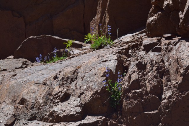
Wildflowers Growing on Boulders
Fallen Tree by the Trail
Blue Wildflowers
View of the Upper Reservoir

It was a beautiful day with the typical bright blue skies of Colorado.  We pushed ourselves as far as a first hike of the season, going for a full two hours and four miles round-trip.  Perhaps because of the hiking that we did in Bolivia, it didn’t seem like too much of a strain, despite the gain in altitude.  To be fair, if you ever read descriptions of hiking trails in the mountains, you’ll often see them described as “moderate”, but any hike in the mountains is going to be strenuous at times, so we usually take the rating lightly and judge for ourselves the difficulty of a trail.  With that said, this really is a moderate trail for anyone used to hiking at altitude.  The trail starts at about 2,200 meters (6,700 feet) and gains about a 700 meters (2,200 feet) depending on which side trail you decide to take, but it gains less if you just hike up to the second reservoir.

Heading Back Down
Gorgeous Views
Upper Reservoir
Clear Blue Sky
The Side Trail that We Took

It was great to get back into the mountains and do some hiking, we’re really looking forward to a full season of exploring new trails.  It is going to be a busy travel season for us, but when we’re not on the road, we want to get out and hike as much as possible.  We live in a gorgeous state and a beautiful part of the country, so we want to take advantage of every opportunity to explore it, even after living here for over twenty years.  If you ever get a chance to visit Colorado during the spring, summer, or fall, get up into the mountains and do some hiking.  Despite how strenuous hiking can be, it is also extremely relaxing and definitely recharges our batteries.

Part of the Trail
Lower Reservoir
View as You Get Close to the Upper Reservoir
Boulders and Pine Trees